After completing Te Ararora, I bought a van and spent the winter working, gearing up for more hiking adventures in the upcoming summer. Having a van as a mobile base allowed me to explore hiking routes beyond the Te Araroa trail. Here are some of my favorite hikes from the summer of 2023/2024:
This loop allows you to see the best of what Abel Tasman National Park has to offer. Incorporating the coastal track with it’s stunning beaches and the lesser visited Inland track taking you through rugged forest.
Hiking as a loop also means you don’t have to worrying about arranging shuttles or water taxis as you start and finish in Marahau where there’s a DOC car park.
The Coastal track is a great walk so you will need to book campsites or huts ahead of time especially in the summer when it gets very busy. The huts on the inland track are first come first served and there are no camping restrictions.
I hiked the whole loop in 4 days but I think 5 would be a more comfortable pace for most people. The coastal track is great walks standard, really easy and fast. The inland track however is in need of maintenance and much slower than I anticipated.
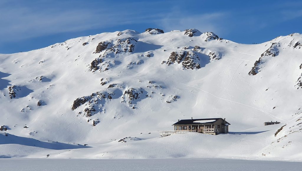
Mount Arthur can be done as a day hike but making it a 2 or 3 day loop allow you take in the best of the tablelands, lake Peel (side trip up to Mt Peel if you’ve got the energy) and to see the interesting Grid Iron hut.
There’s a lot of possibilities in Cobb Valley. Up the Valley to Fenella hut and the loop taking in Mt Gibbs, Round Lake and Lake Cobb is fairly popular choice. If you looking for something a little different and challenging on the way out you can hike along the eastern ridge of valley to Sylvester hut. This section is off trail and anyone attempting it should have good navigation skills the GPX file above should be used as a guide only! There’s also no water on the ridge itself. I dropped down to Ruby lake to camp and top up on water.
I haven’t seen anything else quite like 1,000 acre plateau in New Zealand. After a steep climb you reach the top of a huge plateau with some nice little huts. Larrikin Creek hut marks the end of the official trail but you can continue on a pretty well worn route up to 100 Acre plateau, the Needle or if you’re comfortable with ridges and little bit of scrambling continue up to the Haystack to get a view of both plateaus and the rest of Kahurangi to the North and East.
I’d already done most of this route as part of the Te Araroa but I since the weather wasn’t great the first time, I decided to go back and bag Angelus peak too. I did this a long day hike but you could make it an overnight hike and stay at Angelus hut (booking required).
Right in the heart of Nelson Lakes National park are three passes which make a nice loop (Thompson, Moss and Waiau Pass). There’s a few options for getting to these passes. The easiest way is to hike in over Maling Pass but you could easily incorporate them as part of a longer hike from St Arnaud or Lewis Pass.
Thompson pass doesn’t have an official trail and isn’t marked in anyway. The above GPX file is a rough guide drawn on a map, if you want to hike this route you should be comfortable route finding and navigating.
A strong contender for my favourite hike in a New Zealand! It’s only a short route but is mostly off trail and there’s very likely to be snow either side of the pass so it’s only for experienced hikers.
The above GPX should only be used as a rough guide. there are multiple slips to navigate on the route and very little trail until you reach Ball Hut.
A great day hike up to Sefton Biv gets you very close to glaciers and stunning view down Hooker Valley. If you want to stay overnight get there early as it only sleeps 3 people and is fairly popular. GPX file is a rough route although the route is fairly easy to follow it isn’t marked.
The hike to Brewster glacier is a very popular as either a day hike or overnighting in Brewster hut. I’d recommend taking a short off trail detour up to Mt Armstrong before exploring the are area around the glacier.
There’s a few ways to see Cascade saddle. the GPX above links Raspberry Flat car park and Dart hut. The most popular route to the saddle is to add it on as a side trip when hiking the Rees Dart track. It can also be hiked from West Matukituki but be aware this side is very steep.
The view from the top of Dragonfly Peak is strong contender for my favourite in New Zealand. You get an amazing view of Mt Aspiring and the rest of the National park. There isn’t a trail all the way and it isn’t marked either so you should be comfortable navigating off trail.
Earnslaw burn is quite a popular overnight hike but can be in a day. The end of the valley offers a great view of Mount Earnslaw and Earnslaw Glacier, which is just as good enough not better than the much busier Fox and Franz Josef glaciers.
The imaginatively named Five Passes route takes you over 5 passes (well 4 actually but one of them you do twice) in a much less visited part of Mount Aspiring National Park. I’ve included a short detour to Park pass glacier which is well worth a visit!
Most sites list this as a 55km hike, my watch tracked 73km, including a side trip up to see park pass glacier. I hiked this over 3.5 days because some bad weather came on day 4 and it didn’t look like it was going to improve anytime soon. This felt a bit rushed, if i was to do it again I’d give myself 5 days. I’ve linked my GPX tracks above but most of this hike is off trail and isn’t marked so you should be comfortable navigating and route finding before attempting this hike.
Mount Titiroa is a very unique mountain in New Zealand as its covered in white granite sand which make it looksnow covered from a distance and almost moon-like to hike on. the route up involves quite a lot of bushwhacking but it well worth it!